Posted tagged ‘neighborhood history’

Georgia Avenue Portion of Bruce Monroe Site Originally Private Land, Needed for Build First School Plan in 1970

December 30, 2015

In the current discussion about using a portion of the former Bruce-Monroe Elementary School site as a Build First site for the  redevelopment of Park Morton, one of the arguments that’s been used by those not supporting this solution is that public land should not be given to a private developer. Yet, in an interesting historical twist, the reason for the large size of the former school site that exists today is that the Bruce-Monroe School required a Build First site for its construction, and the solution was to take the private property along Georgia Avenue between Columbia Road and Irving Street by eminent domain in order to create that school. From this perspective, with the school now gone, using the land along Georgia Avenue for a non-public purpose would be restoring it to its use prior to 1970.

This use of eminent domain for new schools was not a unique approach in the late 1960s and early 1970s. Unlike the last decade, during the 1960s DC schools were struggling with over enrollment. Rather than renovate and enlarge old school buildings which is the approach we use today, new schools were often built adjacent to existing schools, and upon completion, the old schools were razed. In Ward 1, this was not only the case with the old Monroe School and the Bruce-Monroe School that replaced it, but it was also the case with the old Morgan School in Adams Morgan which was replace by the Marie H. Reed Learning Center.

The old Monroe School on Columbia Road.

The old Monroe School on Columbia Road.

Discussions to replace the old Monroe School date to the mid-1960s. President Johnson was particularly interested in funding DC schools, though would often see his proposed budget cut by Congress or the District Commissioners. In 1966, it was reported that the funding for a new building to replace the Monroe and Bruce schools had been cut from the budget.

This detail from the 1968 Baist's Real Estate Atlas shows that the Georgia Avenue frontage of the Bruce Monroe site was originally private property with commercial buildings.

This detail from the 1968 Baist’s Real Estate Atlas shows that the Georgia Avenue frontage of the Bruce Monroe site was originally private property with commercial buildings.

1969 was a crucial year for the new Bruce-Monroe school. It was listed as one of 15 new schools that the school system was seeking funding for at the beginning of the year, yet the District School Board decided in February to chop $8 million from its $55 million request resulting in plans for Bruce-Monroe to be shelved. This decision was quickly reversed on April 1st as the $8 million was restored to the original budget request … and the request was approved by the District City Council on April 3rd. However, the total District budget request for 1970 was $728.2 million and President Johnson had already announced a budget of $702 million for the District in January. Perhaps in partial response to this, the school board once again reversed itself on April 25th and removed funding for the new Bruce-Monroe School.

Despite the back and forth funding drama unfolding in April 1969, the project appears to have gotten a delayed approval after a meeting with the community to discuss the proposed replacement of the Monroe School held at the end of May. Over a year later, in September 1970, notices began to appear in the Washington Evening Star announcing the government’s intent to take the private property abutting the school on Georgia Avenue to use for municipal purposes — that being, a new school. The Department of General Services began taking sealed bids on April 23, 1971 with a closing date of May 24th.

Ground was broken on the new school on October 5, 1971, and the $4 million school was completed and ready to serve the community in the fall of 1973. Upon its completion, the old Monroe School was razed save for the old auditorium which was connected to the new school by a causeway.

Bruce Monroe ground breaking(Lisa Nix (left) and Jonathan Brooks (right) break ground for the new Bruce Monroe, October 5, 1971).

Establishing Park View — Part V: Restrictive Covenants and the Growth of the African American Community

August 28, 2015

According to Prologue DC’s Mapping Segregation research:

As Washington grew in the early 20th century, developers commonly sought to shape the character of new neighborhoods by including restrictive covenants (agreements) in deeds for the properties they sold. They might require that only single-family houses be constructed or that buildings be a certain distance from the street. They also might prohibit use of the property as a school, factory, or saloon―or prohibit its sale or lease to certain groups, most often African Americans.[1]

Because deeds are legal contracts, homebuyers needed to pay attention to what they were agreeing to. Buyers who ignored a covenant risked being taken to court, and racial covenants deterred African Americans from moving into new neighborhoods. Covenants also targeted other groups, including Jews. In DC this was more common west of Rock Creek Park.[2]

Starting in the 1920s, racially restrictive covenants also began to be imposed in another manner. Neighborhood associations would gather signatures on petitions that put covenants on the property of each signer, effectively restricting entire blocks. These petitions, which were filed with the Recorder of Deeds as legal contracts, could restrict whole neighborhoods, like Mount Pleasant and Bloomingdale.[3]

Ray Middaugh’s firm Middaugh & Shannon was one such firm to include racial covenants it the deeds for many of the houses they developed, not only in their Park View subdivision but also in the houses they developed in nearby Bloomingdale and other neighborhoods where they were active. Park View, similarly to Columbia Heights, Bloomingdale, and other near in neighborhoods, began their existence as whites-only neighborhoods in close proximity to black communities. Like Middaugh & Shannon, many developers of these neighborhoods often included restrictive covenants in their deeds ostensibly to “maintain” the neighborhoods property values. At the time, it was widely believed that neighborhoods needed to be racially homogeneous to be stable. So widely held was this belief that the Federal Housing Administration institutionalized the practice in the 1930s. (more…)

Establishing Park View — Part IV: The Building Trades Strike of 1907/1908

August 27, 2015

The Building Trades Strike of 1907/1908 had its roots in the “lockout” of the union plumbers by the master plumbers early in 1906, and the difficulties related to this dispute began to impact one trade after another. This culminated in August 1907 when the construction unions united to battle for the cause of organized labor and to uphold the principle of the “closed shop.”

In May 1907, craftsmen occupied in Washington’s building industry met to discuss their dissatisfaction with their working conditions and to seek a remedy. The result of this meeting was a proposal by the building contractors, the master builders and the business men in the District who supply building materials to bring about a settlement of the existing trouble in the building trades. It was also resolved that, if necessary, that supplies of lumber, lime, brick and other materials would be entirely cut off, causing a general shut down of all construction in Washington.

On May 13, 1907, the Building Trades Alliance met and singled out Middaugh & Shannon’s Park View subdivision as a problem and called off their bricklayers, tile roofers, metal workers and metal lathers from the work site. Their issue with Middaugh & Shannon was the use of non-union plumbers, carpenters and painters. The immediate impact on the Park View subdivision was a loss of about twenty mechanics, mostly bricklayers and tile roofers, who had been called off by the strike committee. In order to continue operations, Middaugh & Shannon hired out-of-town nonunion workmen, leading the Building Trades Mechanics’ Council to send a committee to investigate the labor being employed to build the Park Road houses then under construction in mid-June. (more…)

Establishing Park View — Part III: Middaugh & Shannon’s Park View Subdivision

August 26, 2015
Areas in red show location of Middaugh & Shannon's Park View houses.

Areas outlined in red show location of Middaugh & Shannon’s Park View houses.

In December 1905, Middaugh & Shannon purchased the subdivision of Whitney Close which then consisted of approximately nine acres of “splendid land” along Park Road (then Whitney Avenue), west of the Soldiers’ Home grounds. While work to subdivide and develop Whitney Close began in 1886, the property was described at the time of the Middaugh & Shannon purchase as being “subdivided and streets laid out, yet no houses [having] been built there, and [being] looked upon as acreage property.”[1] Middaugh & Shannon purchased the land with the intent of improving the property by erecting up-to-date residences. A key goal of their development was to construct houses that provided light and air, notably with wide lots containing side yards.

Prior to Middaugh & Shannon’s operations in Park View, they had contributed significantly to the development of the Bloomingdale neighborhood. However, unlike the houses constructed in Bloomingdale, Middaugh & Shannon decided to “inaugurate a style of building which [was] an innovation in [Washington, D.C.].”[2] The firm hired architect B. Stanley Simmons to prepare plans for the new section along Park Road. Unlike other projects of the time, the Park Road houses would be constructed as semi-detached houses and not in rows. Simmons also intended to design the structures in a variety of styles to include Old English, Spanish mission, Colonial, and Italian renaissance. (more…)

Establishing Park View — Part II: Developer Middaugh & Shannon

August 25, 2015
William Edward Shannon

William Edward Shannon

William E. Shannon was a partner in the prolific development firm of Middaugh & Shannon. Together with Raymond E. Middaugh (1870-1910), Shannon constructed over 900 dwellings in Washington, D.C. The team was instrumental in developing the neighborhoods of Bloomingdale, Park View, Woodley Park, 14th Street Terrace, Petworth, Michigan Park, and part of Saul’s Addition.

William Edward Shannon was born in Baltimore, Maryland in 1875 and came to Washington, D.C. in 1881 at the age of six. He attended Washington, D.C. public schools and Spencerian Business College in Washington, D.C. His first job was as a page for the United Press, stationed on the floor of the Senate and House. Later, he worked as a messenger at the Evening Star, a printer, and then a real estate broker. He married Lilian A. Walingford in 1899.

Shannon began working with Ray E. Middaugh in 1896 and the two formed the real estate firm of Middaugh and Shannon in 1900. Their first development project was the construction of row houses in Bloomingdale within the area bounded by R Street, North Capitol Street, Bryant Street, and 2nd Street, NW. From 1900 to 1901, architect B. Stanley Simmons (1872-1931, see Architects Directory entry) designed 47 of these row houses for Middaugh & Shannon. Beginning in 1902, however, the firm relied almost exclusively on Joseph Bohn Jr. (1877-1910, see Architects Directory entry) as its architect.

Middaugh & Shannon pioneered the development of Bloomingdale. The Washington Post’s 1903 History of the City of Washington reported that as a result of Middaugh & Shannon’s initial development in the neighborhood, there were 869 houses, accommodating 3,484 people, by 1903. As advertised in the newspaper, their houses were built to embody their ideals of what housing should be, not only of construction, but also of arrangement, i.e., their copyrighted plan for the perfect lighting of the dining room.

In 1906, the firm began developing the Park View neighborhood immediately west of the Old Soldiers Home. Joseph Bohn designed the row and semi-detached dwellings in this development, including virtually all the dwellings constructed in the two squares (3044 and 3036) between Park Place and Warder Street, N.W. and bounded by Newton Place on the north and Lamont Street on the south. Bohn’s final works (1909) for Middaugh & Shannon were two rows in Mt. Pleasant at 19th Street (3201-3215) and Park Road (1844-1860) and a row of Colonial Revival dwellings along Cathedral Avenue in Woodley Park (2228-2242). Shannon & Luchs were the selling agents of many of Middaugh & Shannon’s developments. Herbert T. Shannon (1884-1946, see directory entry), co-founder of Shannon & Luchs, was the younger brother of William E. Shannon. (more…)

Establishing Park View — Part I: Whitney Close

August 24, 2015

This week, I’ll be posting a short series of articles outlining the establishment of the neighborhood’s first successful subdivision — Middaugh & Shannon’s Park View subdivision. Today provides and introduction and focuses on the first attempt to create a subdivision in the area in 1886. Following days will focus on builders Middaugh & Shannon, their Park View subdivision, the building trades strike of 1907/1908, and the establishment of the African-American community in a formerly “whites only” area of Washington, D.C.

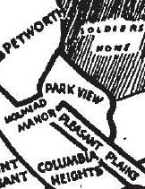
The Park View neighborhood in its entirety can trace its organization and name to March 1, 1908, when the Park View Citizens’ Association first convened at the old Whitney Avenue church. The name “Park View” was chosen due to the community’s close proximity to the U.S. Soldiers’ Home and as an expansion of Middaugh & Shannon’s Park View subdivision along Park Road. The earliest known description of the boundaries for the Park View neighborhood is found in the first issue of the Park View News (1916). All known subsequent descriptions of the neighborhood agree with those published in 1916. The most clearly stated description comes from the 1917 Constitution and By-Laws of the Park View Citizens’ Association and is provided below.

. . . bounded as follows: By the south side of Gresham Street on the south, Rock Creek church Road on the north, Soldiers’ Home grounds on the east, and both sides of Georgia Avenue from Gresham Street to Park Road; thence west to both sides of Park Road to New Hampshire Avenue; thence north on the west side of New Hampshire Avenue to Rock Creek Church Road.

Detail from 1903 Baists Real Estate Atlas showing boundaries of Whitney Close.

Detail from 1903 Baists Real Estate Atlas showing boundaries of Whitney Close.

Park View’s roots date to June 4, 1886, when the heirs of Catherine M. Whitney sold the former estate of Asa Whitney, known as Whitney Close, to Benjamin H. Warder of Ohio for the sum of $60,024. Warder immediately set about subdividing the 43 acre tract of land into building lots for a new community.

As detailed on Wikipedia, Benjamin H. Warder is an interesting character. He co-founded Warder, Brokaw & Child Company, and paid $30,000 for patent rights to “The Champion,” a combined reaper & mower invented by William N. Whiteley. Warder’s company manufactured the machines, but distribution was shared, at first, with Whiteley and others. By 1860, the Springfield, Ohio, firm was just Warder & Child.

Warder’s company manufactured harvesting machinery – reapers, binders, mowers and hay rakes – under the “Champion” brand name. Warder and Bushnell managed the factories in Springfield. The company opened a branch office in Chicago in 1865, headed by Glessner, which grew to become its most profitable: in 1871, the Chicago office sold about 800 machines; in 1884, it sold 25,000 machines. By 1886, the company employed more than 1000 workers, and was exporting to foreign countries.

Warder retired from business in 1886, and moved his family to Washington, DC, where his house at 1515 K Street, NW, was under construction (the house has since been moved to 16th Street). His subdivision of Whitney Close appears to be among his first forays into D.C.’s speculative real estate market. He was also among the investors involved in subdividing Petworth the following year in 1887.

Whitney Close houses(3567 and 3569 Warder Street, NW. These two houses date to 1893 and are possibly the sole remaining houses from the Whitney Close subdivision.)

Unfortunately, Warder’s vision for Whitney Close was not realized due to a number of reasons, and actual development was initially slow with only a handful of wood-frame houses constructed.

By 1904, however, a strong economy, an ever decreasing availability of near-in land, and large public green spaces such as the Soldiers’ Home and the McMillan Reservoir, all set the stage for Park View to finally take off. Middaugh & Shannon were the first builders to begin large scale development in Park View, beginning with their purchase of nine acres of the Whitney Close subdivision along Park Road in December 1905 and construction beginning in February 1906.

Tomorrow: Builders Middaugh & Shannon

Park View Field House Renovation Nearly Finished

August 7, 2015

This will probably be the final update on the Park View Field House at the recreation center before the project is completed. It is essentially completed now, and the majority of punch list items are expected to be completed by Wednesday, August 12, 2015, including removal of the temporary construction fence.

Below are photos of the (nearly) finished project.

Park View Field House

IMG_1158

IMG_1156

Park View rec center interior

IMG_1144

Mapping Historic Segregation in Washington DC Resource Now Available

June 18, 2015

It is impossible to fully understand Washington’s neighborhoods without a good understanding of the housing segregation that once held sway here. It is a legacy that in many ways shaped the city, which in turn still has an impact today. This makes it all the more critical to understand this past.

Historians Sarah Shoenfeld and Mara Cherkasky have begun to document this history in maps. Their Mapping Segregation in Washington DC effort is a public history project documenting the historic segregation of DC’s housing, schools, playgrounds, and other public spaces. To date the project has focused on racially restrictive housing covenants. Racial covenants had a dramatic impact on the development of the nation’s capital decades before government-sanctioned redlining policies were implemented in cities across the country.

The interactive Website is now live, and free to explore here. Shoenfeld and Cherkasky’s work is far from finished, and only reflects information they’ve been able to gather so far.

Restricted Housing DC(Details showing Restrictive Covenants in the Park View area.)

Historic Neighborhood Groups — Park View Citizens’ Association

March 13, 2015

The Park View Citizens’ Association is the second post today from the series on historic neighborhood civic groups from the 1940s. This article was originally published ion the Washington Post on November 11, 1940.

Park View map 1940

Park View banner

Park View article 1940

Historic Neighborhood Groups — Petworth Citizens’ Association

March 13, 2015

Keeping the series on historic neighborhood civic groups from the 1940s going, this is the first of two articles that I’ll post today from the Washington Post. It focuses on Petworth. The original article was published on November 10, 1940.

Petworth Citizens map 1940Petworth Citizens 1940 article